

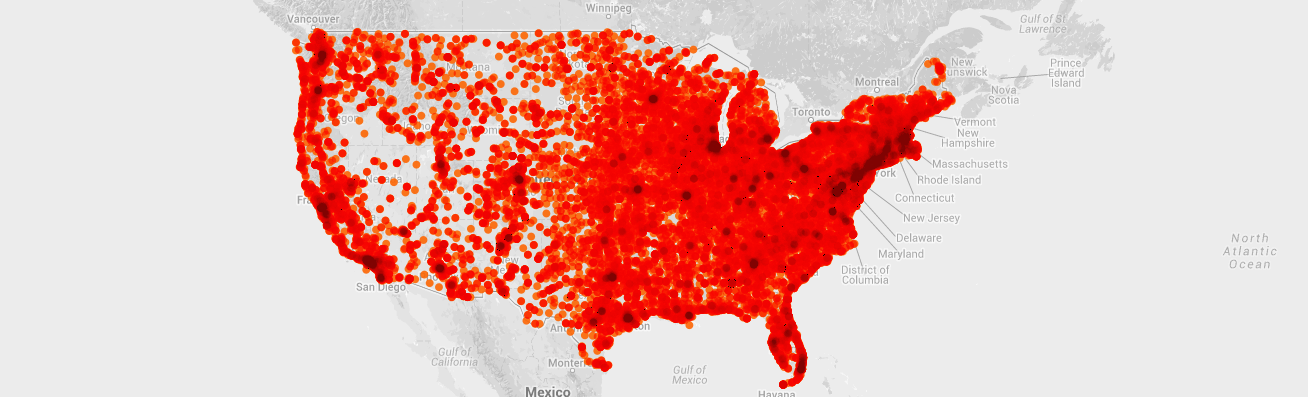
Museums in the United States according to data from IMLS Museum Count survey. http://bit.ly/11ejwae
Using data to design marketing campaigns is great. Using data as an accountability tool to report back to our funders is also great. Even if we’re not leveraging it to its full potential (chances are we’re not), most of us would agree on the last two statements.
It’s when we start talking about incorporating data-driven-decision making to our programming that things start to get complicated. Programming directors support their decisions on a thoughtful understanding of the underlying values of a particular art form, values that theorists have spent years trying to understand. Data, it seems, has no place in the business of the aesthetic experience.
I will spend the next couple of months trying to prove us wrong. By no means will I attempt to show that data analysis can replace the role of curators and artistic directors; instead, I will try to understand as an arts manager when, and how, we can incorporate spatial data to develop helpful variables in the programming decision making process.
So what is spatial data? It’s simply information that relates to a specific geographic location; it can cover a large area, -a state or a country- refer to a specific point in the map -the location of a school- or anything in between. Naturally, this is more beneficial in some fields; I will draw examples of how this would be useful for public art projects since they are, by nature, embedded in a physical location, and from community outreach programs in an effort to show how we can be more proactive reaching the audience that they will benefit the most.
Unlike other projects involving data analysis, we already have high quality datasets available through private and government agencies; because these are the planning stages, we work with demographics and statistics about our potential audience, not the people we already reach. Of course, if we have comparable past examples, collecting and using our own data would enrich our efforts, but it’s not absolutely necessary.
Spatial location can help us visualize the idiosyncrasies of our towns and neighborhoods. So, can we understand if the Rubber Duck will work the same way it did in Hong Kong when we bring it to Pittsburgh? Can it help us decide if we should place a permanent or a temporary piece in that particularly high traffic spot downtown? Are we maximizing our audience when we cluster works in a sculpture park, or would we be better serving our mission if we scattered them around a main avenue? Data can be used not only to measure the success of our programming after the fact, but also to make the most educated decision about what is optimal when we’re faced with a set of choices.
I would love to hear your comments and questions, please post them below or feel free to email editor@amt-lab.org